Whilst this map reflects the overall boundaries of the Eruv – if you live, or intend to walk on Shabbat, near a boundary line, you will need to ensure that you understand the exact line of the eruv boundary. If you are unsure, please contact the Eruv Committee on info@eboreruv.org.
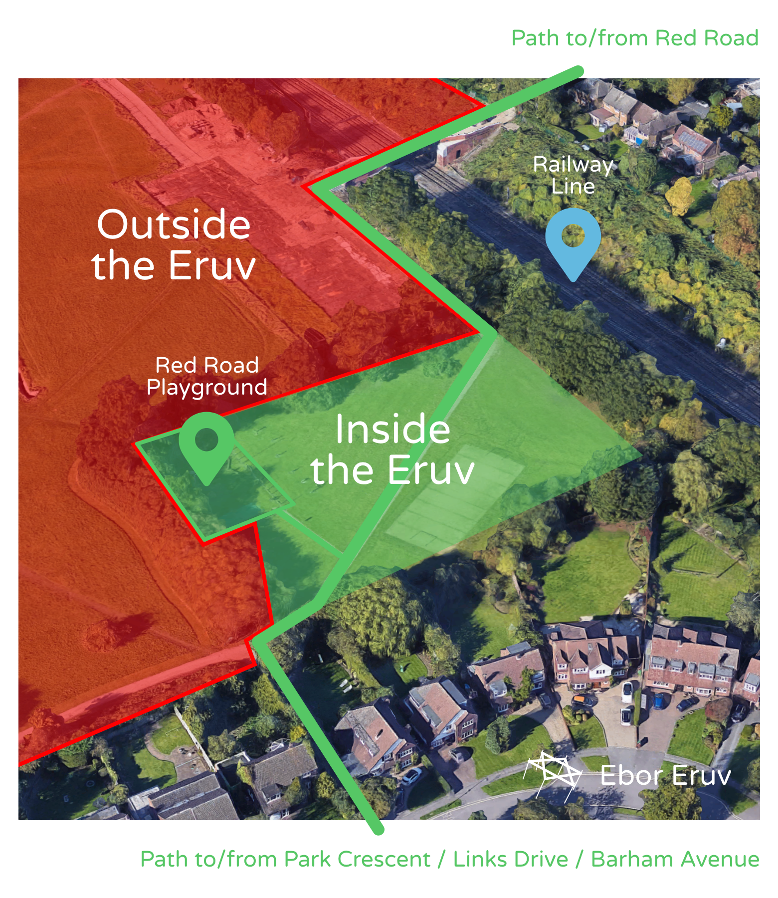
There has been some confusion regarding the area covered by the Eruv within the park behind Red Road/Park Crescent/Barham Avenue. The route is as follows:
When entering the park from Red Road across the railway bridge and through the gates, the Eruv boundary runs along the side of the path to the left. The grass area on the right-hand side of the path is OUTSIDE of the Eruv.
Once the tree-line has been passed, the boundary then includes the grass to the right of the path with the boundary running alongside the tree line down to the play area. The play area itself is included within the Eruv. The boundary continues on the side of the play area and cuts the grass area in two.
The boundary continues to allow you to exit the park through the pathway to the junction of Barham Avenue, Park Crescent and Links Drive.
This picture (click to enlarge) shows what is included and excluded – areas shaded RED are outside the eruv, areas shaded green are inside.
Please contact the Eruv Committee on info@eboreruv.org with any queries.